

A River Runs Through It: The Duwamish River’s original path as shown through historic survey maps
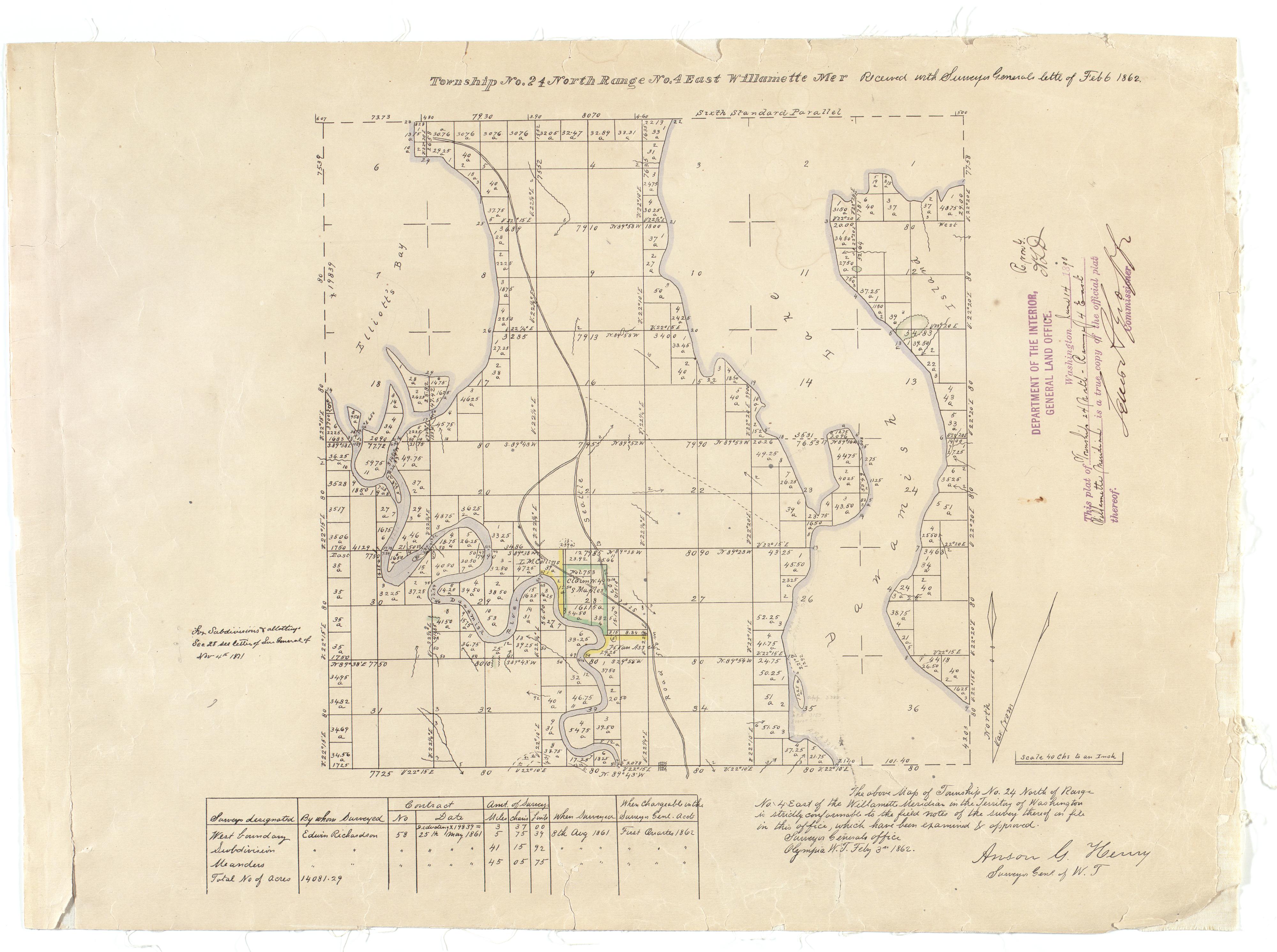
1862 survey showing the river's original path
This 1862 survey of what is now Seattle, shows the Duwamish River (Dxwd?w) as a wide, meandering river with large areas of mudflats and marshes. By 1913, the straightening of the river into the Duwamish Waterway had begun.
The Washington State Archives holds in our collections the plat maps created by the Surveyor General of Oregon from 1852 to 1854; the Surveyor General of Washington from 1854 to 1925; the General Land Office from 1925 to 1944; and the Bureau of Land Management from 1946 to 1980.Written by Ben Helle