

Treasures of the Archives: Oyster Bed Maps
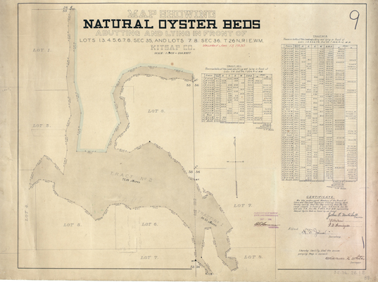
The abundant natural resources of Washington State are recorded in many ways in the archives. This curious item is a map of natural oyster beds in Kitsap County, across Puget Sound from Seattle. The farming of the sea has long been a tradition in Washington going back to the original native population. Puget Sound and the Washington Coast were always a breeding ground for oysters. So much so that the state’s Board of Shore and Tide Land Appraisers commissioned the creation of maps such as these. Valuable to the historian, these maps show not only the coastlines, property boundaries, and family histories, they are also valuable to scientists tracking the loss of natural habitats and species in an era of climate change. The Digital Archives has over two dozen such maps. Do a search for “oyster” in the general map collection, 1851-2005 to see much more.